Joshua Tree
Where two deserts meet, the boulders climb themselves, and Gram Parsons is the local saint.
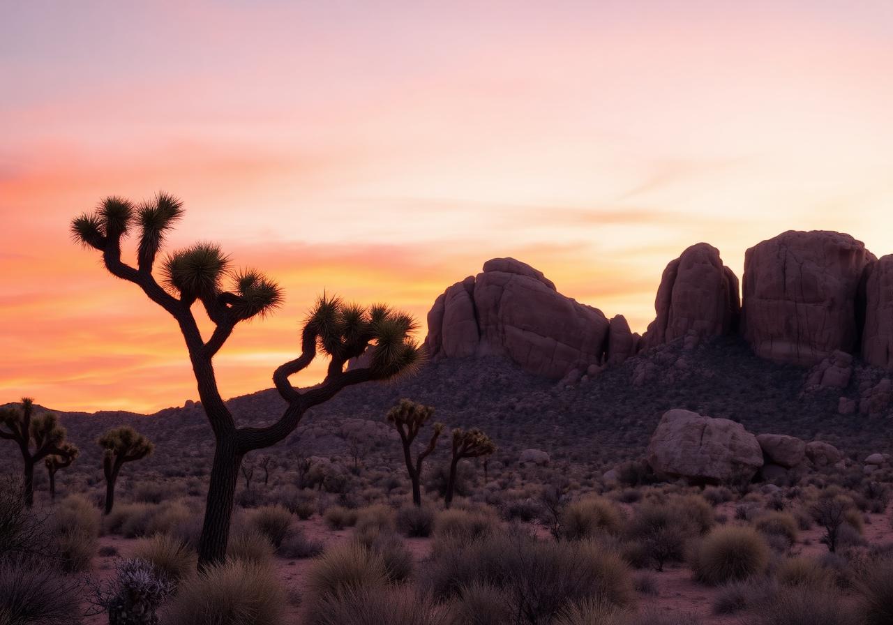
Joshua Tree National Park sits at the meeting of the Mojave (high) and Colorado (low) deserts — and the difference is visible to the eye. The park is full of monzogranite boulders, twisted Joshua trees, and a counterculture history that runs from Gram Parsons to U2 to Hipgnosis. This hunt mixes accessible park stops with the music history just outside the gates.
Your route
Pinch to zoom. Tap a marker to see the stop name. The dashed line traces the suggested walking order.
Turn-by-turn stops
Each stop shows the walking distance and direction from the previous one, plus a tap-through to your phone's maps for step-by-step directions.
- 01
Hidden Valley Trailhead
"Begin in the high desert. The mile loop circles a basin of monzogranite. Find the boulder shaped like a skull."
34.0114, -116.1689Start walking here - 580 m~8 min walkhead SSW from stop 102
Cap Rock
"A boulder with a flat cap, beside the road. Stand under the overhang. This is also the Gram Parsons memorial site."
34.0067, -116.1717Walk from stop 1 - 4.7 mi~101 min walkhead E from stop 203
Skull Rock
"Beside the main park road, a boulder eroded into a skull. Walk the half-mile loop behind it."
33.9986, -116.0900Walk from stop 2 - 7.4 mi~158 min walkhead SW from stop 304
Keys View
"Drive to the top of the road. The view stretches a hundred miles. Find the relief map at the overlook."
33.9264, -116.1850Walk from stop 3 - 7.2 mi~154 min walkhead NNE from stop 405
Barker Dam
"1.3-mile loop. Walk to the dam. If there's been rain, find the petroglyphs on the rock face."
34.0244, -116.1428Walk from stop 4 - 14 mi~302 min walkhead ESE from stop 506
Cholla Cactus Garden
"Drive south into the low Colorado Desert. Walk the boardwalk through 10 acres of teddy-bear cholla. DO NOT TOUCH."
33.9244, -115.9292Walk from stop 5 - 2.1 mi~44 min walkhead NW from stop 607
Ocotillo Patch
"Just up the road. Find the spindly plants with red tips after rain."
33.9450, -115.9550Walk from stop 6 - 16 mi~347 min walkhead SSE from stop 708
Cottonwood Spring Oasis
"Drive south to the park's south entrance. Find the oasis with the date palms."
33.7392, -115.8208Walk from stop 7 - 48 mi~1025 min walkhead NW from stop 809
Pioneertown
"Drive 30 min west out of the park. Walk Mane Street. Find the false-front saloon."
34.1581, -116.4839Walk from stop 8 - 10 mi~215 min walkhead E from stop 910
Joshua Tree Inn (Room 8)
"Drive into the town of Joshua Tree. Walk the public courtyard. Find the small altar at Room 8."
34.1306, -116.3119Walk from stop 9 - 6.2 mi~133 min walkhead N from stop 1011
Noah Purifoy Outdoor Sculpture Museum
"10 acres of assemblage sculpture in the high desert. Find the throne made of TV sets."
34.2200, -116.3008Walk from stop 10 - 16 mi~348 min walkhead SSE from stop 1112
Sunset at Hidden Valley Picnic Area
"End back where you began. Find a flat boulder. Watch the granite turn pink."
34.0114, -116.1717Walk from stop 11