Santa Ana River Trail
Canyon mouth to open ocean — 30 miles of paved riverbank.
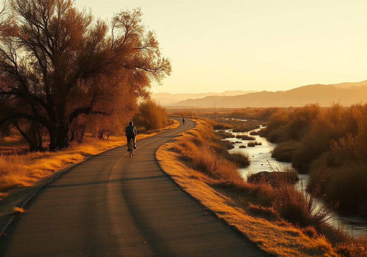
The Santa Ana River Trail is Orange County's longest continuous Class I bike path, running roughly 30 paved miles from the mouth of Santa Ana Canyon down to where the river finally meets the Pacific between Huntington and Newport Beaches. This hunt starts at Canyon RV Park inside Featherly Regional Park, drops out of the canyon past Yorba Linda and Anaheim's stadium district, threads behind the cities of Orange and Santa Ana, crosses under the 405, and finishes at the river's mouth on Huntington State Beach. It's almost entirely flat, fully separated from car traffic, and best done by bike — though the lower 10 miles are very walkable.
Your route
Pinch to zoom. Tap a marker to see the stop name. The dashed line traces the suggested walking order.
Turn-by-turn stops
Each stop shows the walking distance and direction from the previous one, plus a tap-through to your phone's maps for step-by-step directions.
- 01
Canyon RV Park (Featherly Regional Park)
"Start at the park entrance off Gypsum Canyon Road. The bike path enters the riverbed levee just outside the campground gate — find the trailhead sign with the green OC Parks logo."
33.8679, -117.7135Start walking here - 3.0 mi~65 min walkhead W from stop 102
Yorba Regional Park
"Roll west on the south levee. After about 5.5 miles, the trail hugs a chain of grassy lakes on your right. Find the wooden footbridge over the lagoon — Shelter #1 is just past it."
33.8694, -117.7662Walk from stop 1 - 6.6 mi~142 min walkhead WSW from stop 203
Burris Basin
"Continue west and south. About 4 miles past Yorba Regional, the trail rises onto a wide levee wrapping a huge open water-recharge basin on your west side. Find the chain-link gate at the basin overlook."
33.8266, -117.8694Walk from stop 2 - 1.4 mi~29 min walkhead SSW from stop 304
Honda Center & Angel Stadium
"About 8 miles further the river opens up beside Anaheim's sports district. Find the round, copper-roofed arena on your right (north bank) and the big 'A' of Angel Stadium just beyond."
33.8078, -117.8763Walk from stop 3 - 2.0 mi~42 min walkhead SSW from stop 405
Katella Avenue & The Outlets at Orange
"Just south of the stadiums, the trail crosses under Katella. Look east (left) — you can see the rooftop signage of one of the largest outlet malls in the country."
33.7828, -117.8923Walk from stop 4 - 1.7 mi~36 min walkhead ESE from stop 506
Discovery Cube Orange County
"Look up. Just south of Katella, the giant blue cube balanced on one corner is impossible to miss from the bike path."
33.7700, -117.8678Walk from stop 5 - 4.2 mi~91 min walkhead SW from stop 607
Centennial Regional Park (Santa Ana)
"Roll past downtown Santa Ana to your east. About 5 miles south of the cube, the trail passes a large lake on the river's east side. Find the pedestrian bridge across to the park."
33.7200, -117.9100Walk from stop 6 - 2.4 mi~51 min walkhead W from stop 708
405 Freeway Crossing & Fountain Valley Sports Park
"The trail passes under the wide, low concrete deck of Interstate 405. Just past it on the west bank, find the green fields and tennis courts of Mile Square's eastern neighbor."
33.7248, -117.9510Walk from stop 7 - 5.4 mi~116 min walkhead S from stop 809
Talbert Regional Park & the Riparian Corridor
"Past the 405 the river widens into a broad floodplain. The trail runs the levee with a 180-acre wild park on your west side. Find the unpaved spur trail leading down into the willows."
33.6469, -117.9483Walk from stop 8 - 0.6 mi~14 min walkhead SSW from stop 910
Victoria Street Bridge & Costa Mesa Wetlands
"Continue south. The trail crosses under Victoria Street, the last major bridge before the ocean. From here you can smell the salt — find the sign for the Greenville-Banning Channel junction."
33.6388, -117.9540Walk from stop 9 - 0.7 mi~14 min walkhead SW from stop 1011
PCH Crossing & River Jetties
"The trail dips one final time, under the Pacific Coast Highway bridge. As you emerge, the river is funneled between two long rock jetties pointed straight at the surf — find the path onto the north jetty rocks."
33.6314, -117.9613Walk from stop 10 - 320 m~4 min walkhead SW from stop 1112
Huntington State Beach (River Mouth · End of the Hunt)
"Roll the final stretch onto the beach bike path. Stop where the asphalt curves to meet the surf — the river drains into the Pacific right at your feet. You made it."
33.6290, -117.9633Walk from stop 11